 vesseltracker.com
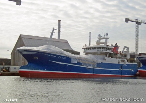
Vessel 'GERDA MARIE' IMO: 9762259, MMSI: 257521000
UTC, 57.11783, -7.17131, course: 199, speed: 12.3
UTC, 57.11783, -7.17131, course: 199, speed: 12.3
2026-02-10 11:12:52 UTC, 57.11783, -7.17131, course: 199, speed: 12.3
Live AIS position:
UTC. Near South Uist and Eriskay),
updated 2026-02-10 11:12:52 UTC.
Find the position of the vessel 'GERDA MARIE' on the map. The latter are known coordinates and path.
marine traffic ship tracker show on live map
The current position of vessel 'GERDA MARIE' is 57.11783 lat / -7.17131 lng. Updated: 2026-02-10 11:12:52 UTCDetails:
Last coordinates of the vessel:
UTC, 57.30781, -7.05635, course: 195, speed: 12.2UTC, 57.11783, -7.17131, course: 199, speed: 12.3
UTC, 57.11783, -7.17131, course: 199, speed: 12.3
2026-02-10 11:12:52 UTC, 57.11783, -7.17131, course: 199, speed: 12.3